top of page

Search


How to use Thermal Temperature Scaling with Drone Data in Hammer Missions?
Want to bring out those thermal anomalies? Check out our post on thermal temperature data scaling.
Feb 282 min read

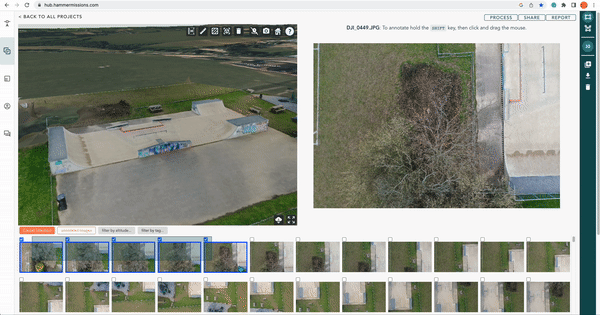
How to tag and filter your data for Drone Inspections?
In this guide, we look at how you tag and filter your images for drone inspections.
Feb 13, 20243 min read

Types of Stockpile Volume Calculations from Drone Mapping
In this article, we look at the different methods of calculating stockpile measurements from drone mapping for construction earthworks.
Sep 29, 20232 min read


How to use Ground Control Points (GCPs) for Drone Mapping?
In this guide, we'll go through the step by step process on how to plan, capture and process GCPs for drone mapping.
Sep 19, 20233 min read

How to Process Your Thermal Data with Hammer Missions?
In this guide, we go through the steps to process your thermal data in Hammer Missions.
Jul 25, 20232 min read

Drone Flight Planning with 3D Models | Hammer Missions
In this post, we look at how to create drone flight plan from an existing 3D model of the site.
Jul 11, 20232 min read


Using the DJI M300 with Hammer Missions
How to use the DJI M300 with Hammer Missions. An end-to-end guide for drone mapping, drone 3D models and inspection.
Jun 19, 20235 min read


How to Verify Your Drone Data On-Site? | Hammer Missions
In this article, we look at how to use Hammer Missions to verify your drone data before leaving the job site ensuring high-quality data.
Jun 5, 20232 min read

How to Capture a Solar Farm not on Google Maps using Drones? | Hammer Missions
In this article, we will take you through the process of how to capture solar farms not on google maps using drones and Hammer Missions.
Jun 5, 20233 min read

Using 4D Models in Hammer Missions
In this tutorial, we will be looking at how you implement your drone data projects into a 4D models and timeline.
Mar 30, 20233 min read
Multi-Selection with Hammer Missions
Select multiple photos with ease as opposed to clicking on individual photos one at a time, process partial datasets.
Mar 2, 20232 min read

2D Drone Maps (Orthophotos) on Hammer Missions
In this short guide, we will take you through the steps to create a 2D map (orthophoto / orthomosaic) with Hammer Missions.
Feb 10, 20232 min read


Overlaying CAD files with Drone Data
This short tutorial will take you through the steps to get your overlays placed on top of your existing captured 2D drone data.
Feb 10, 20233 min read

Accuracy of Stockpile Volumes from Drone images | Hammer Missions
In this study, we look at how accurate are the stockpile volume calculations from drone images, 3D models and hammer missions.
Jan 27, 20233 min read

How To Use The Mavic 3E with Hammer Missions
Steps on using DJI Mavic 3 Enterprise (M3E) drone with Hammer Missions.
Jan 18, 20232 min read

Site Planning Tools | Hammer Missions
How to use site planning tools (point of interest, ruler, area) in Hammer Missions
Dec 22, 20224 min read

Automatic PDF Reports | Hammer Missions
How to automatically create PDF reports from drone mapping & inspection data using Hammer Missions.
Dec 9, 20223 min read

Mission Layers in Hammer Missions
In this article, we will look at how to add mission layers to Hammer Hub, and plan two or more flight plans on the same site.
Nov 21, 20223 min read

Volumetric Measurements with Drone Data | Hammer Missions
In this article, we look at how to conduct Volumetric Measurements on Drone 3D models.
Nov 15, 20222 min read

How to 3D Map and Inspect a Building in the same project | Hammer Missions
This post explains how to 3D map and inspect a building in the same project using Hammer Hub, by Hammer Missions.
Nov 9, 20223 min read


How to install Hammer Missions on the DJI Smart Controller
In this guide, we will walk you through how to install Hammer Missions App on the DJI Smart Controller for DJI's Enterprise Drones.
Nov 3, 20223 min read

Using Measurements in Hammer Missions | Drone Mapping
A step-by-step tutorial on how to make measurements (distances, areas, volumetric) using drone imagery and 3D models.
Nov 1, 20223 min read

Annotating Drone Data in Hammer Missions
In this article, we will look at how to annotate drone data for surveys and inspections using Hammer Hub.
Oct 2, 20223 min read

Resuming Flights from a Custom Start Point | Hammer Missions
In this post, we will look at the workflow and steps involved in starting the drone flights in the Hammer App from a custom start point.
Sep 26, 20222 min read
bottom of page