top of page

Search


Drone Photogrammetry for Buildings: 20 Tips for Repeatable Results
Capturing buildings using drone photogrammetry requires careful planning and a bit of skill. Here are 20 tips to achieve the best results.
May 22, 20245 min read

Comparing NeRF, 3D Gaussian Splatting, and Drone Photogrammetry in Geospatial Applications
Do you want your data to be visually compelling or accurate or both? Here we compare NeRF, Gaussian Splatting & Drone Photogrammetry.
Feb 4, 20243 min read

Captured vs Aligned Images in Drone Photogrammetry: What is it and why does it matter?
In this post, we explain the difference between captured vs aligned drone images in drone photogrammetry.
May 24, 20233 min read


What are Ground Control Points? Drone Mapping | Hammer Missions
We look at what are GCPs (ground control points), their importance for accuracy of drone mapping and compare them with RTK/PPK methods.
Mar 21, 20234 min read

Accuracy of Stockpile Volumes from Drone images | Hammer Missions
In this study, we look at how accurate are the stockpile volume calculations from drone images, 3D models and hammer missions.
Jan 27, 20233 min read

Improving the Quality of your Drone Maps and 3D Models
In this post, we explore how you can greatly improve the quality of your drone maps and 3D models by focusing on key data capture workflows.
Oct 24, 20226 min read
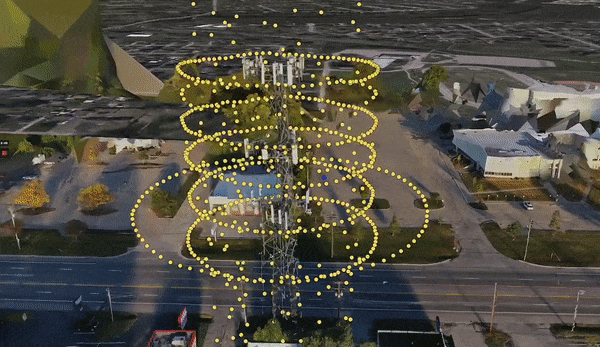
Drone Cell Tower Inspections: Step-by-Step Guide
Drone Cell Tower Inspections - a step-by-step guide from data capture to data processing. Sharing 3D models, digital twins, PDFs and more.
Sep 19, 20225 min read


Camera Specs & Megapixels - Do they matter for Drone Photogrammetry?
A case study on drone camera megapixels and their impact on drone mapping and photogrammetry. Three 3D models were captured and processed.
Aug 30, 20228 min read

Drone Photogrammetry Software: How does it work under the hood?
Drone Mapping & Photogrammetry has become a common place. This guide looks at the steps involved in mapping and photogrammetry.
Aug 23, 20224 min read
Processing Drone 3D Models
Overview In this guide, we will look at how to create a 3D mapping workflow and the process of how you turn your captured data into a...
Jul 15, 20223 min read

How to create 3D Models using Drones & Hammer Missions
In this article, we will be discussing how to capture data for 3D mapping using drones.
Jun 24, 20224 min read

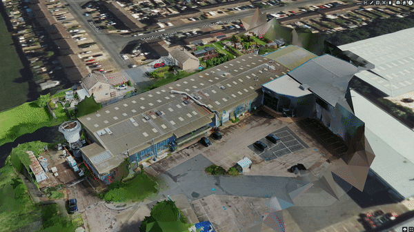
A Guide to Drone Photogrammetry
In this guide, we will explain the process and how you would achieve the 3D Output whilst maintaining the highest quality data collection.
Jun 14, 20224 min read


How to Collect High Quality Data for Photogrammetry
Overview As a Drone Operator we know that the collection of high-quality data is imperative to producing the best quality image, whether...
Apr 27, 20226 min read
bottom of page