Insurance & Loss Adjusting
Property Risk
Assessments
Faster & Smarter
The way insurers assess commercial properties is changing. Traditional inspections are time-consuming, subjective, and costly, especially across large or remote portfolios.
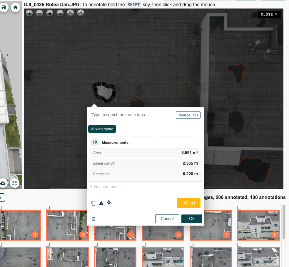
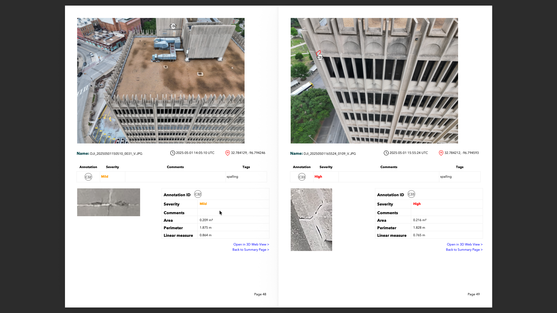
With Hammer Missions, you can capture detailed aerial data and generate AI-powered insights in a fraction of the time. Our platform delivers high-resolution, geo-tagged imagery combined with intelligent condition scoring, helping underwriting, claims, and risk teams make decisions with confidence.
Why
Insurance
Professionals
Use Us
Real-Time, Geo-Tagged Data
Capture current conditions with aerial imagery and AI-generated condition scores. Improve accuracy in claims evaluation and premium recalibration post-CAT.
Underwriting with Speed
Generate quotes for new business without a site visit. Objective, desktop-ready data reduces turnaround time and supports better pricing decisions for SOVs.
Renewals Made Easier
Use before-and-after comparisons to track property changes year over year. Quantify deterioration and maintenance, enabling better-informed renewal pricing.
Loss Control with Insight
Visual heatmaps highlight defect trends (e.g., flashing failures, ponding) across portfolios — prioritising inspections, documenting compliance, and supporting risk engineering teams.
Reduce Risk,
Not Just
Premiums
Insurance today is about precision, not guesswork. Hammer Missions transforms drone imagery into actionable insights — helping insurers detect roof defects, verify damage, and monitor property conditions over time.
With AI-powered analysis and visual reporting, you can underwrite faster, validate claims objectively, and manage portfolios with confidence — all from a single platform.
Frequently Asked Questions
Hammer Missions supports most DJI Enterprise drones for flight planning & AI analysis.
For 3D modelling & AI analysis, you can also use Skydio, Parrot or Autel drones.
You can find a complete list over here: https://www.hammermissions.com/supported-drones
Hear It from Our Customers
"Manually documenting and quantifying the facade deficiencies would've been nearly impossible without Hammer Missions. These tools, combined with engineering principles and careful review, have provided a baseline for saving and repurposing this landmark building"
- Clay Harman, Associate, Senior Engineer at RDH Building Science Inc.
Get Started